


McKinley County Precinct 15, McKinley County, New Mexico
About
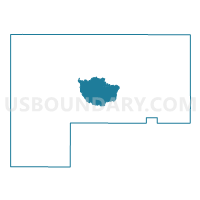
Outline

Summary
| Unique Area Identifier | 623711 |
| Name | McKinley County Precinct 15 |
| County | McKinley County |
| State | New Mexico |
| Area (square miles) | 218.15 |
| Land Area (square miles) | 217.83 |
| Water Area (square miles) | 0.32 |
| % of Land Area | 99.85 |
| % of Water Area | 0.15 |
| Latitude of the Internal Point | 35.55849720 |
| Longtitude of the Internal Point | -108.20166840 |
Maps


Graphs
Select a template below for downloading or customizing gragh for McKinley County Precinct 15, McKinley County, New Mexico


Neighbors
Neighoring Voting District (by Name) Neighboring Voting District on the Map
- McKinley County Precinct 10, McKinley County, NM
- McKinley County Precinct 13, McKinley County, NM
- McKinley County Precinct 14, McKinley County, NM
- McKinley County Precinct 16, McKinley County, NM
- McKinley County Precinct 23, McKinley County, NM
- McKinley County Precinct 52, McKinley County, NM
- McKinley County Precinct 53, McKinley County, NM
- McKinley County Precinct 8, McKinley County, NM
Top 10 Neighboring County Subdivision (by Population) Neighboring County Subdivision on the Map
- Red Rock CCD, McKinley County, NM (24,280)
- Navajo Nation CCD, McKinley County, NM (10,107)
- Crownpoint CCD, McKinley County, NM (5,609)
Top 10 Neighboring Place (by Population) Neighboring Place on the Map
Top 10 Neighboring Unified School District (by Population) Neighboring Unified School District on the Map
Top 10 Neighboring State Legislative District Lower Chamber (by Population) Neighboring State Legislative District Lower Chamber on the Map
- State House District 6, NM (27,357)
- State House District 69, NM (26,984)
- State House District 5, NM (25,172)
Top 10 Neighboring State Legislative District Upper Chamber (by Population) Neighboring State Legislative District Upper Chamber on the Map
Top 10 Neighboring 111th Congressional District (by Population) Neighboring 111th Congressional District on the Map
Top 10 Neighboring Census Tract (by Population) Neighboring Census Tract on the Map
- Census Tract 9436, McKinley County, NM (5,846)
- Census Tract 9460, McKinley County, NM (5,677)
- Census Tract 9437, McKinley County, NM (3,854)
- Census Tract 9435, McKinley County, NM (3,423)
- Census Tract 9440, McKinley County, NM (2,186)
Top 10 Neighboring 5-Digit ZIP Code Tabulation Area (by Population) Neighboring 5-Digit ZIP Code Tabulation Area on the Map
- 87313, NM (5,662)
- 87323, NM (4,558)
- 87311, NM (4,208)
- 87045, NM (1,751)
- 87316, NM (1,304)
- 87312, NM (579)